Urban Highways & City Life
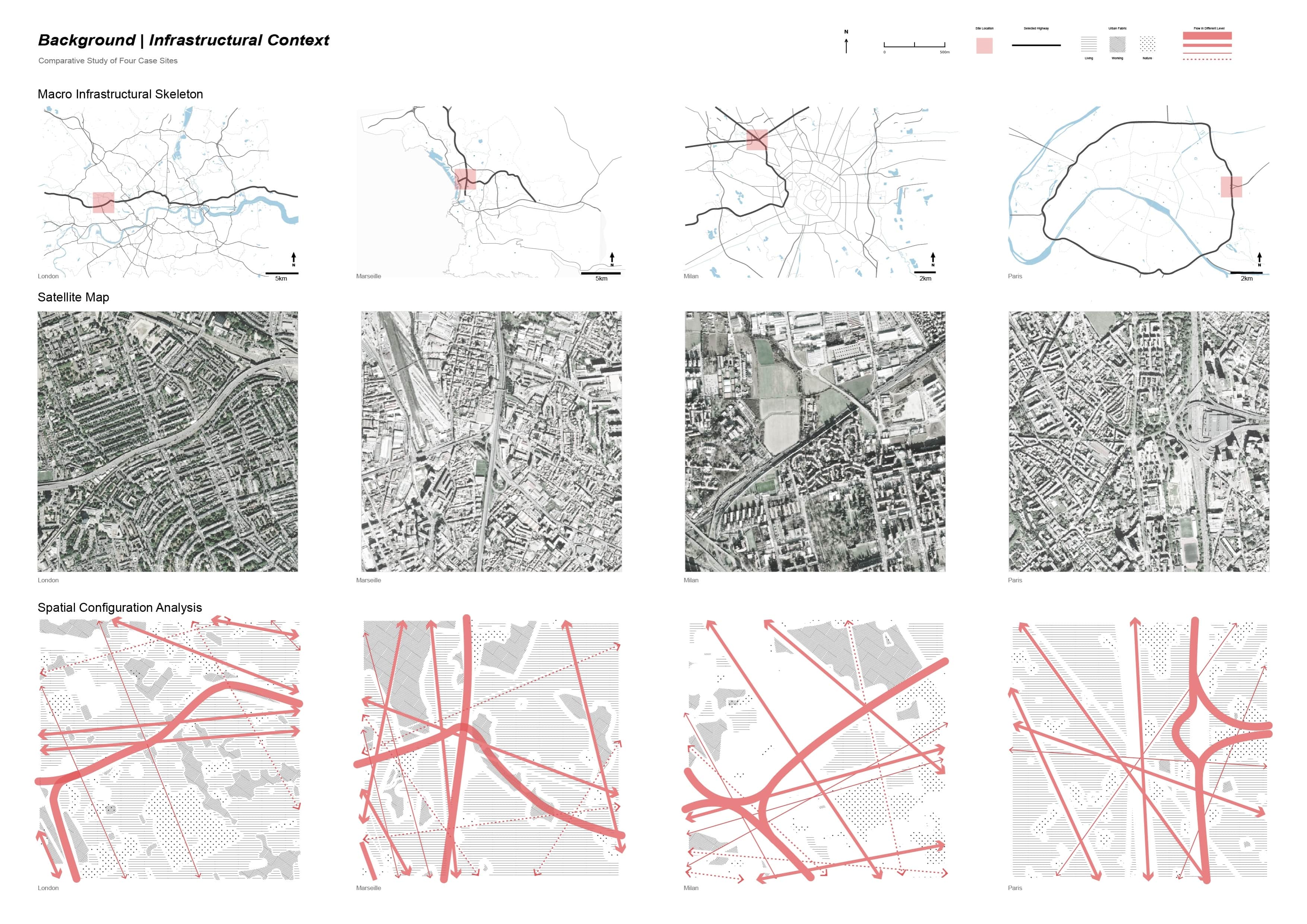
Cross-City Comparative Analysis
A comparative study of four European metropolises, analyzing the "emotional topography" of highway infrastructure using computer vision and NLP to decode public sentiment.
Keywords:Urban Computing, Sentiment Analysis
Role:Data Analyst & Researcher
Team:Individual
Technique:Python (NLP/DPT), ArcGIS, Google Map API, Openstreetmap, Adobe Suite
Date:2025.08
Decoding the structural impact of highways on European urban fabric through data lenses.
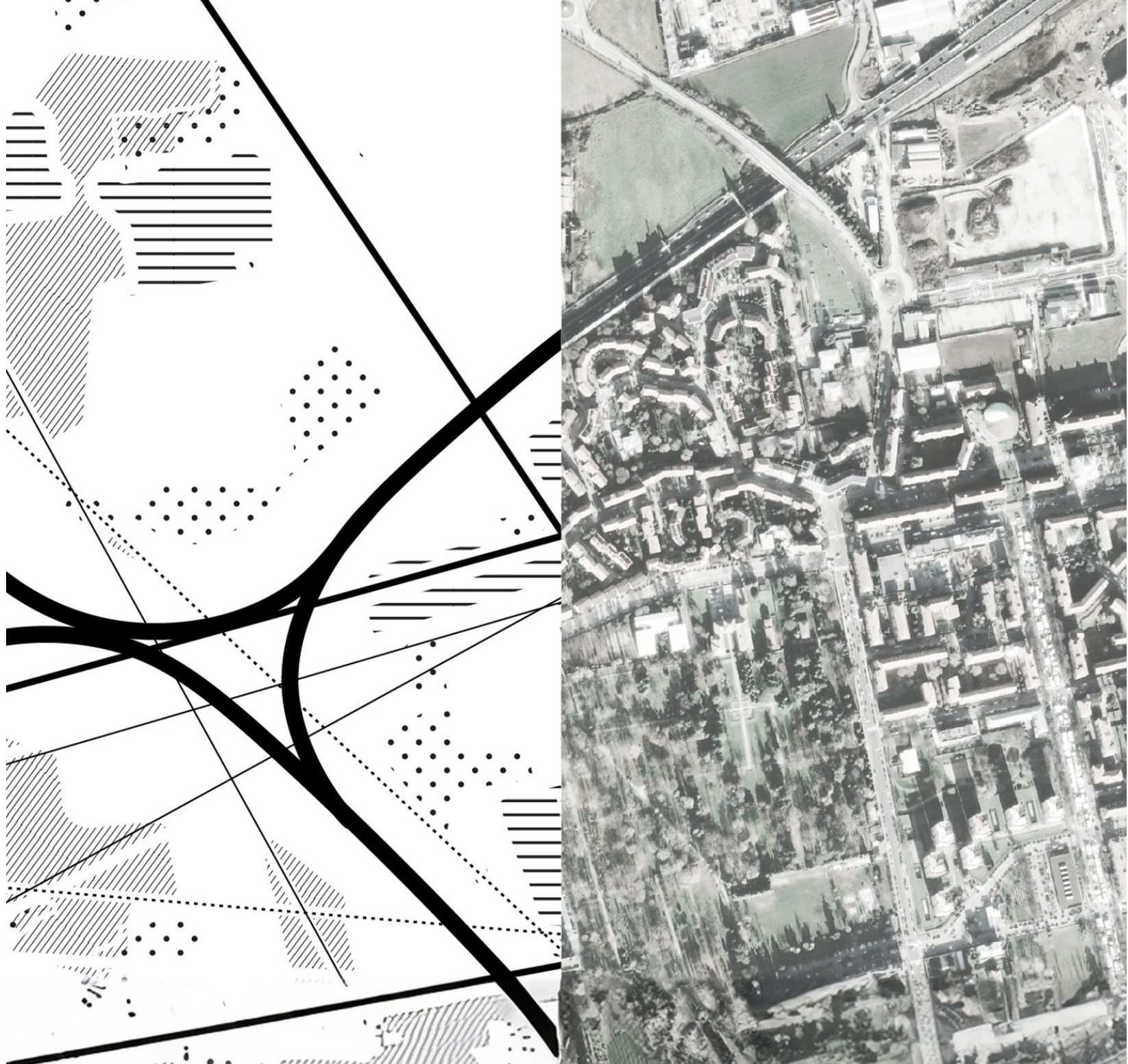
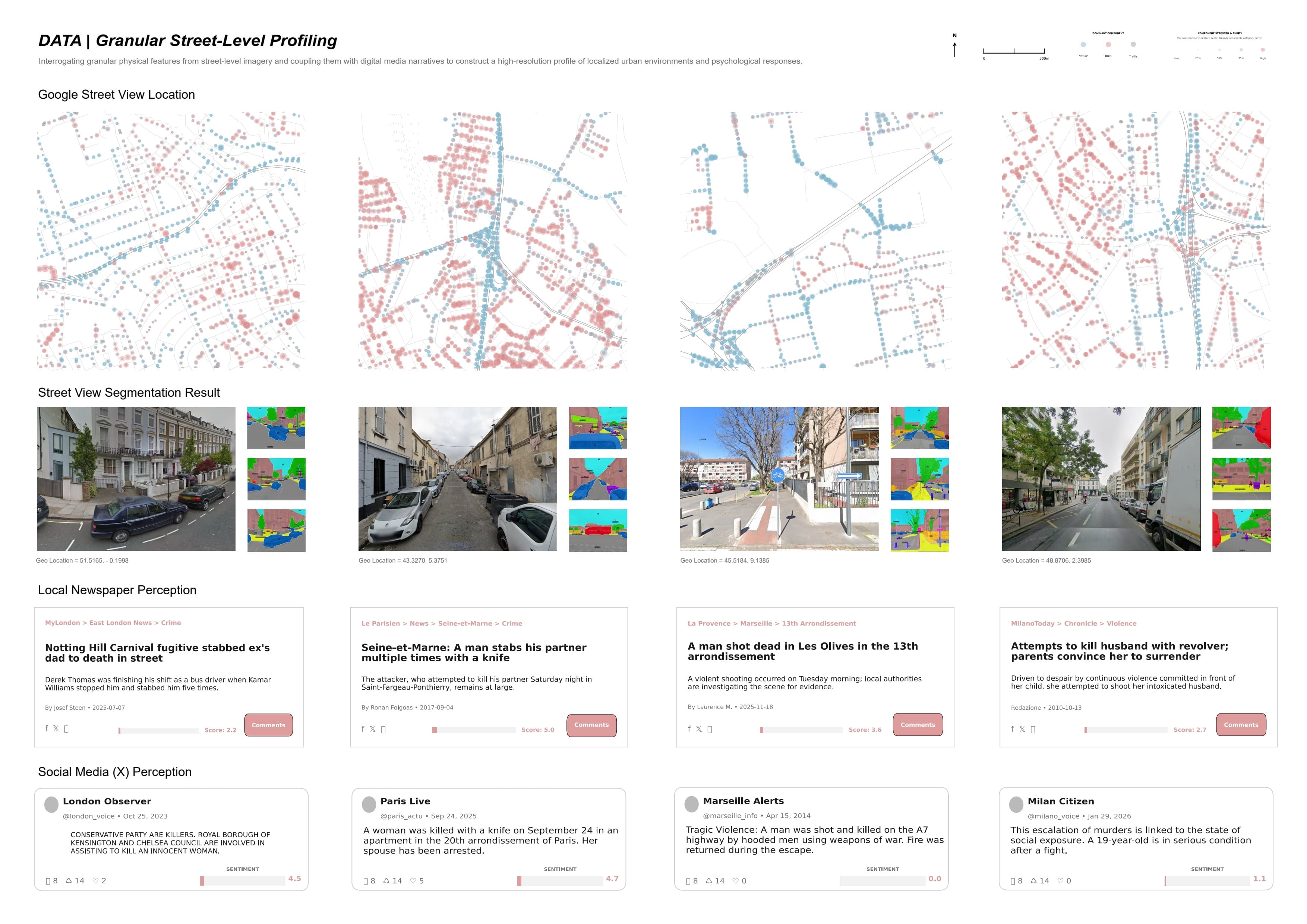
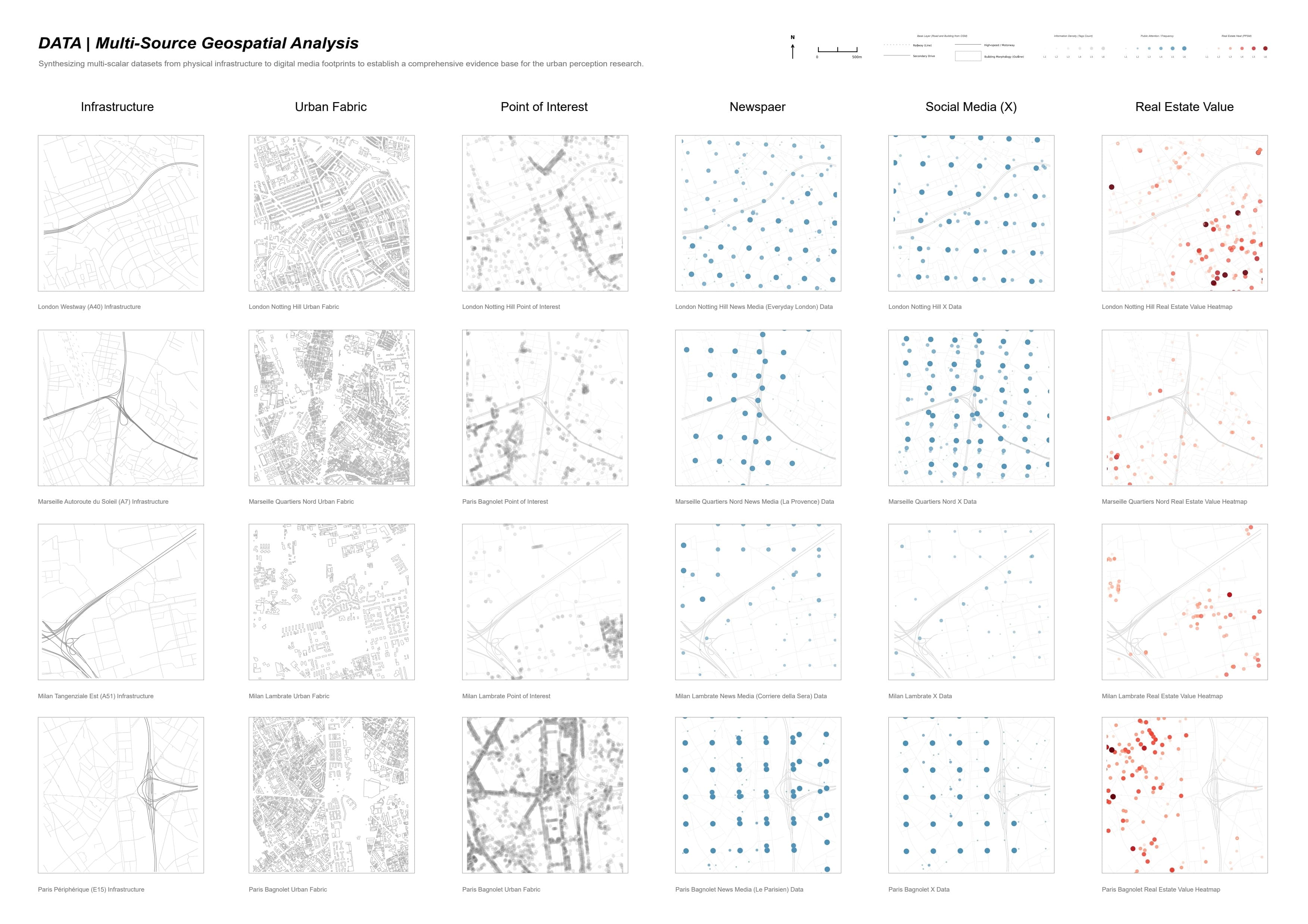
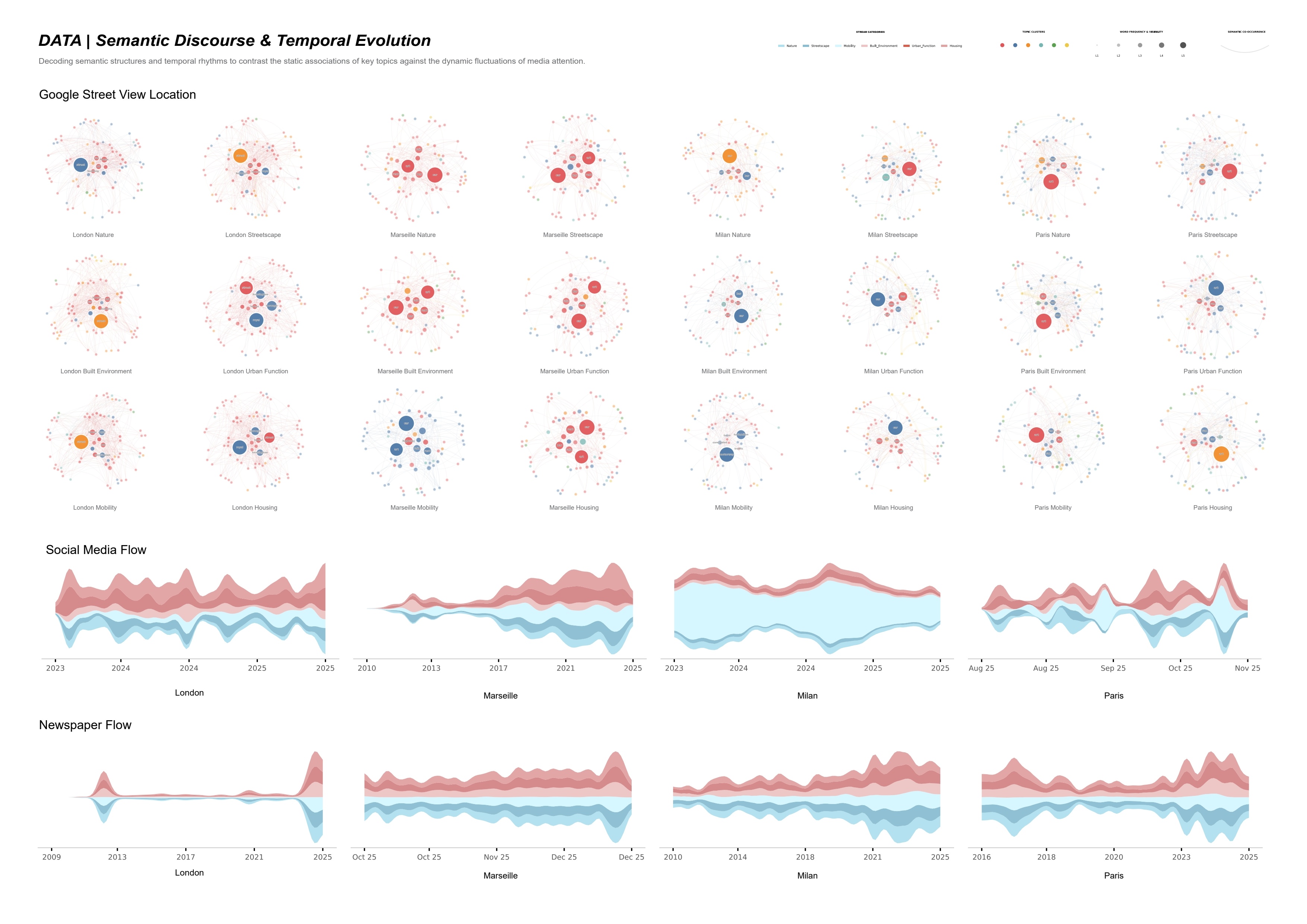
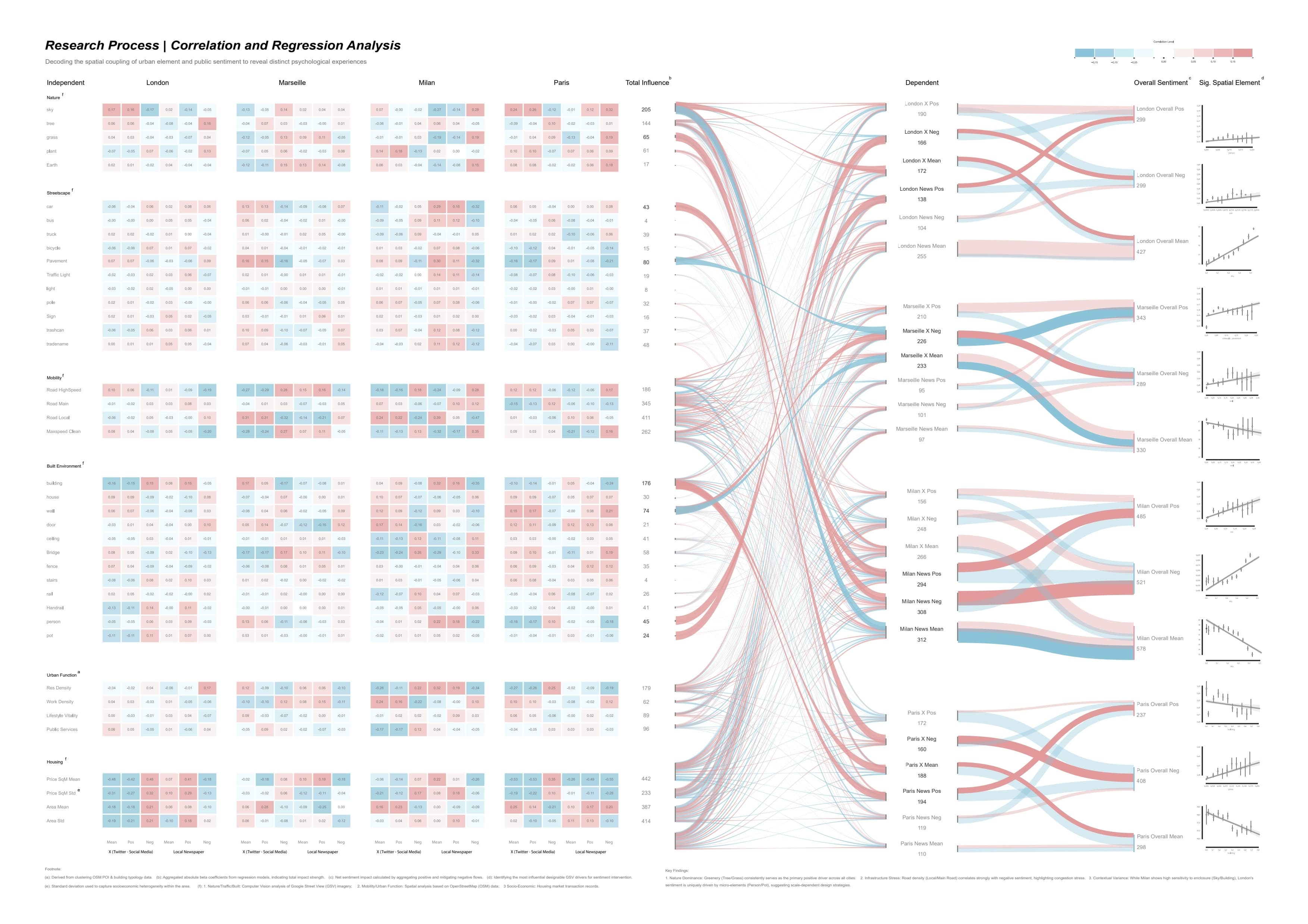
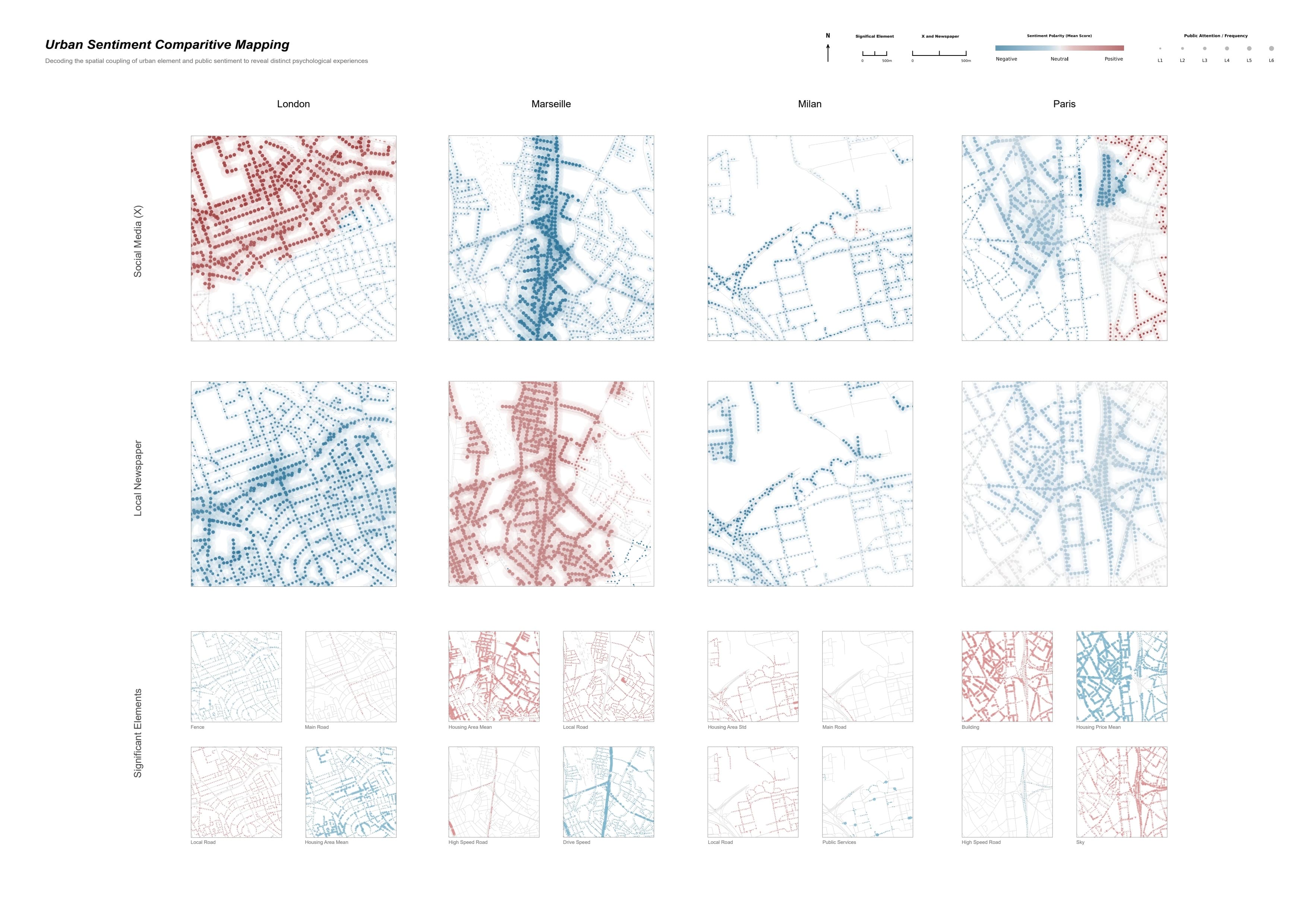
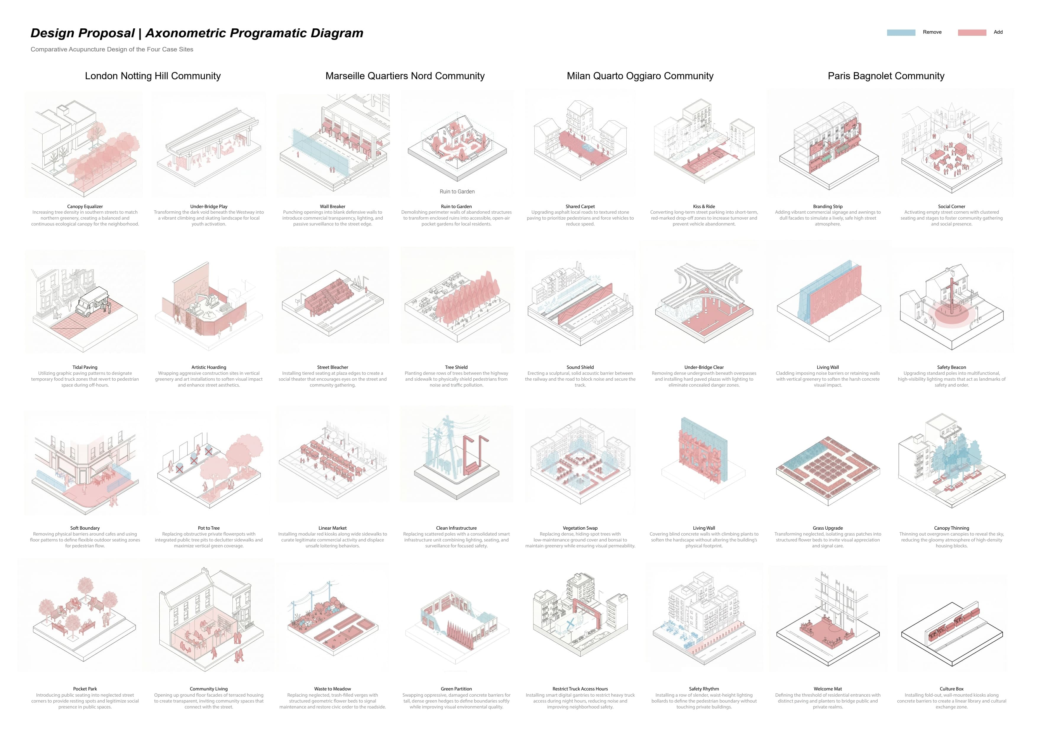
In the dense fabrics of four European metropolises, the "rational" utility of highway infrastructure is overlaid by a dynamic "emotional topography." This project investigates the dissonance—and the Emotional Bias—between these utilitarian arteries and public perception. Focusing on the concept of Non-Neutral Infrastructure, I integrated computer vision and natural language processing to decode the urban interface. I processed over 31,000 Google Street View images to quantify 31 spatial features, while simultaneously parsing social sentiment from Twitter and local news. By mapping emotional intensity against spatial composition via linear regression and Sankey analysis, the project reveals how specific micro-elements (such as sky exposure or greenery) act as invisible "levers" that trigger distinct sentiments. The outcome is a comparative "Spatial Lever Atlas," offering data-driven strategies to transform rigid barriers into emotionally resonant public spaces.
Thanks for reading